2016-05-26 A Special Weekend In Washington DC

2016_05_19_18_48_07_AWB-002

We have been wanting to bring Magnolia to Washington DC but truthfully its a long way. To drive from Annapolis MD to Washington DC is 35 miles, to sail, its 165 miles. You see our dilemma and why it has taken us this long. With some planning an the appropriate motivation we pulled it off. Our friends Bryan & Gail live at perfect stop and a perfect stop for friends from Dahlgren to stop as well! Along with that there are numerous  family and friends in Washington and not forgetting the Pentagon Sailing Club where we learned the basics of what we do everyday. It was time to make the trek!

Capture-1

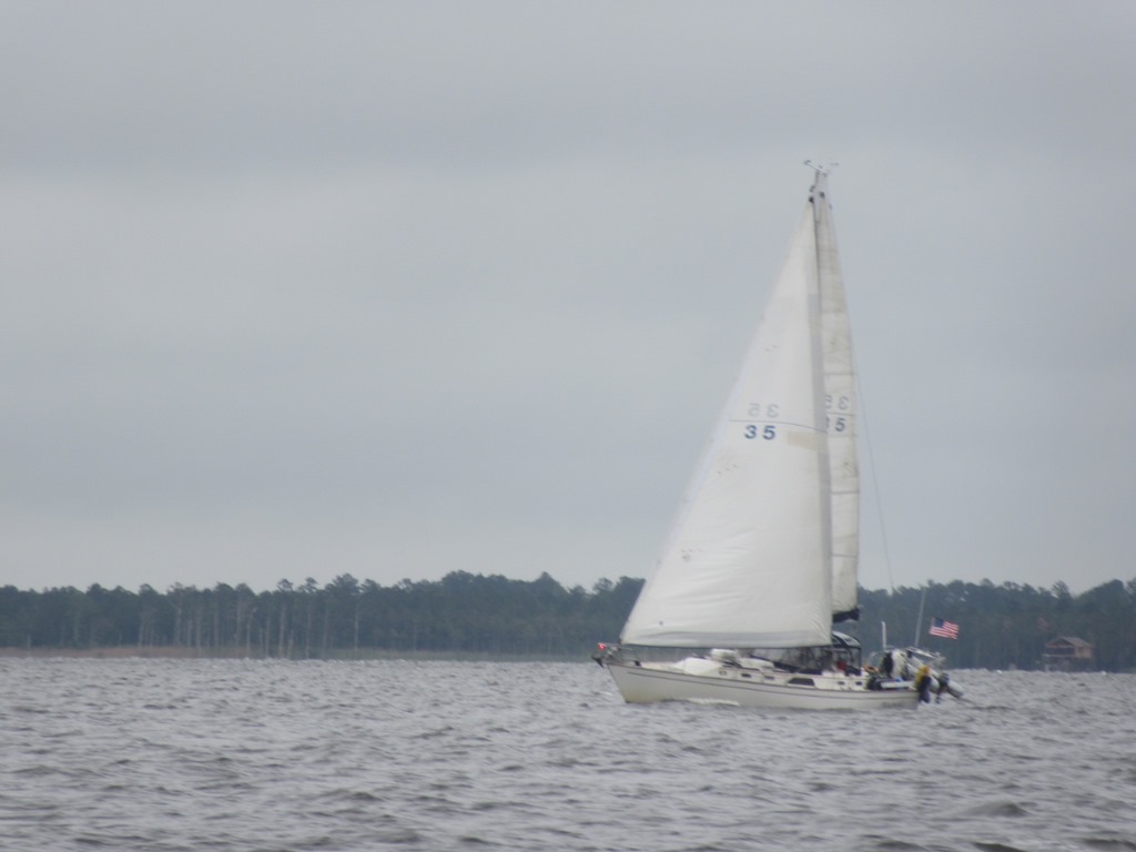
As we departed Hampton we were very excited about the forecast because we would be able to sail all the way to the Potomac River, nearly 55 miles distant. Yea that quickly went out the window with winds right on the nose. The heck with that so we bailed out in early and stopped in Reedsville MD.

image

We had not anchored in this spot since 2013 but it was one we know. Its worth taking a moment to read that story at “2013-07-11 What we learned on our passage to Reedsville

Capture-3

Capture-4

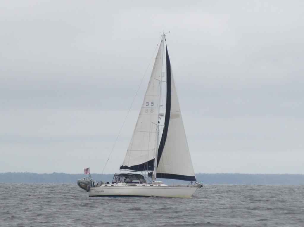
As we rounded Smith Point we waved to our friends Bentley and Jim on Salty Paws and entered the Potomac River. It was cool and wet day with little wind. Just a day to make some miles.

2016_05_17_14_13_22_AWB-014

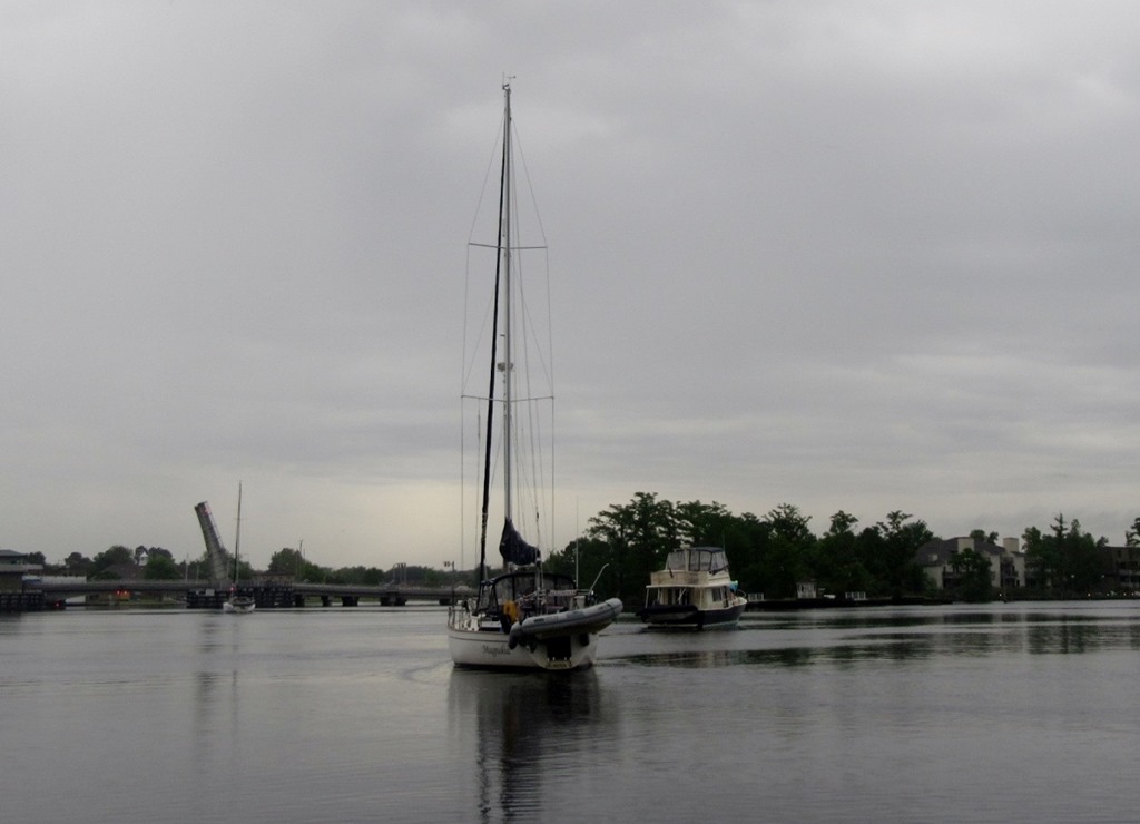
It was certainly a soup day but we really were warm and comfortable inside Magnolia’s enclosure.

2016_05_17_14_20_47_AWB-015

St. Clement’s Island State Park is one of those places we will put in our back pocket for a time through when its dryer! Looks like a great stop though.

2016_05_17_15_13_24_AWB-017

We have equipment onboard that tells us where commercial vessels are bound…this guy was going somewhere on the Potomac to NYC. Have no idea what the heck they are shipping to NYC.

Capture-5

Capture-6

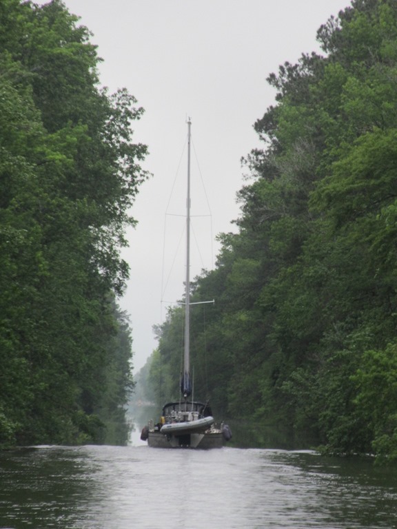
After quiet and wet night at Swan Point we were heading into more familiar waters around Dahlgren and King George County VA.

2016_05_18_10_58_52_AWB-022

Governor Harry W. Nice Memorial Bridge – I have driven over this bridge a million times but have not sailed under it since the late 1980s when I had a bass boat and fished these waters

2016_05_18_10_58_36_AWB-021

Naval Surface Warfare Center Dahlgren Division – I worked here in the past at different time since 1982…if all goes according to plan I will only see it from this distance in the future!

2016_05_18_11_26_30_AWB-023

Looking back south from Mathias Point towards Dahlgren.

2016_05_18_11_49_13_AWB-028

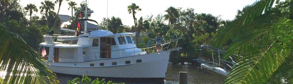
Magnolia anchored off shore Fairview Beach, VA framed of course by a Magnolia Tree! Thank you Bryan Metts for the terrific picture.

13225169_10153409345272294_1544986712_o

Annette, Gail, Bryan & Mark at Tim’s II in Fairview Beach. These are the moments Annette and I live for and appreciate it when friends can take time out of their busy schedules to meet up like this!

2016_05_18_19_46_20_AWB-029

Capture-7

Capture-9

We made an early start for Washington.

2016_05_19_10_21_11_AWB-034

The first vessel we passed was this rather unique looking craft. It turns out it this is the “M-80 Stiletto” It was pretty cool as it passed!

2016_05_19_13_25_28_AWB-047

Now this is certainly a different view on Mt Vernon…have to say my favorite!

2016_05_19_13_45_13_AWB-052

Who would have thunk it…there really is a Fort Washington at Fort Washington…I never thought about it…

2016_05_19_14_22_50_AWB-055

The new casino going into National Harbor

2016_05_19_14_29_32_AWB-059

Another bridge I have driven across a million times…this time though we go under it. The sailing club would not let us go any further south than the bridge….

2016_05_19_14_40_19_AWB-001

The Torpedo Factory in Old Town Alexandria…now an Art Haven

2016_05_19_14_41_12_AWB-004

Annette’s Sister taking a picture of Annette taking a picture of her.

2016_05_19_14_51_39_AWB-069

2016_05_19_14_53_46_AWB-071

2016_05_19_14_55_14_AWB-073

2016_05_19_14_59_21_AWB-076

Bolling Air Force Base,  homeport for the pentagon Sailing Club and where it all started for Annette and I

2016_05_19_14_59_36_AWB-077

National Airport

2016_05_19_15_04_01_AWB-083

National War College and Capitol beyond.

2016_05_19_15_04_10_AWB-085

“C1 Washington Harbor”

2016_05_19_21_56_38_AWB-092

National War College

2016_05_20_18_21_38_AWB-009

Annette’s Sister Rochelle and Robbins – first visitors of many this fun filled weekend!

2016_05_20_23_31_07_AWB-001

2016_05_20_19_57_10_AWB-095

Dee from the Pentagon Sailing Club took the picture of above of Annette and I..thanks Dee!

2016_05_20_21_49_53_AWB-099

GenIV night aboard Magnolia…wait wait how did the GenIV get aboard?

2016_05_20_21_50_00_AWB-102

2016_05_20_22_50_13_AWB-105

2016_05_21_13_34_55_AWB-012

My fellow GenIV Maria with Eric and their GenV..btw not the first time I have gotten that look!

2016_05_21_17_37_02_AWB-020

Just a sample of the many guest we had from Pentagon Sailing Club through the weekend.

2016_05_22_17_14_53_AWB-023

“A tradition continues!” As the crew of Magnolia was preparing to go cruising, our mentors gave a us a Bahamian Courtesy Flag to hang on the office wall to keep us focused. This year we found the perfect recipients of 2015/2015 flag. Greg & Mary Jerrell. Stay focused and we look forward to seeing you down the coast

2016_05_23_10_13_38_AWB-001

As quickly as the weekend began it was over and Magnolia was underway.

2016_05_23_10_19_16_AWB-005

2016_05_23_10_36_07_AWB-012

2016_05_23_10_39_12_AWB-015 (2)

The red arrow points to the condo we had in Arlington, below is the view from there…we waited a long time to get the reverse image view!

Nightview Office Crystal City

2016_05_23_15_02_42_AWB-024

2016_05_23_12_21_11_AWB-027

Laura and Christopher, this one is for you, I believe its the Officers Club at Ft Belvoir.

20160525_101846

The great thing about DC is the swag…Magnolia sailed away with a haul. Thank you David Kriescher and Mary Jerrell.

image

Magnolia has another 170 mile week as we head out to Cambridge to east some oysters (imported) and hit the farmers market ahead of the PSC festivities in nearby Oxxford MD over Memorial Day weekend.

2016-05-23–Hampton VA

After our trip through North Carolina we were looking forward to a little “still” time.

 2016_05_07_16_19_45_AWB-004

Our first stop in Hampton was an evening at Old Point Comfort Yacht Club. We are actually members though we are generally observers from a distance.

2016_05_07_16_20_36_AWB-003

On this occasion we were able to participate in the spring blessing of the fleet. 

2016_05_07_16_21_49_AWB-002

After the winter Magnolia was so challenged we figured an extra blessing was in order.

2016_05_08_19_25_10_AWB-001

One of our favorite stops in Hampton is, stet was Ice Cream Parlor. I am sad to report the it was not only the weather that was tough..it appears the parlor did not survive either.

2016_05_09_13_41_52_AWB-002

One of the jobs I normally get done in the Abacos is a maintenance coat of varnish of the cap rail. The weather in the Abacos and then again during our stop in S.C. did not allow this job to get done.

2016_05_09_13_42_10_AWB-003

Though the weather in the Hampton was hit and miss I did get a couple of coats of varnish laid down. Have to start with a good sanding of the existing varnish.

2016_05_09_13_42_49_AWB-005

Magnolia is really ready for a complete strip down of the varnish but I just do not have time in the schedule to get it done…there is just too many other more fun things to do!!!

2016_05_13_14_49_41_AWB-010 (2)

In the end the finished product met minimum requirements which is about all I can say!

2016_05_13_14_46_05_AWB-008

Magnolia snuggled into the dock at Sunset Boating Center, Hampton

13226971_10207527803890744_4114665964856601326_n

While Annette was away on her cousins weekend our friend Jim on SV Agape arrived. We met Jim in Black Point Exumas and have crossed paths along the way.

2016_05_15_20_45_57_AWB-011

As Jim was on his way back to Toronto Canada and was preparing to go offshore to New York. It was great to catch up on our final night in Hampton.

2016_05_19_18_48_07_AWB-002

Next we are off to Washington DC!

2016-05-15 “Race to DC”

image

We depart Hampton VA for Washington DC in the AM. It is 183 miles and have days to complete…the goal being to keep the Admiral happy! I originally was hoping to do it in 3 travel days and keep one in reserve but I believe I might have be over optimistic. I do not think we will make it to Fairview Beach/Dahlgren till Weds… Hence no days to spare, We will see……

2016-05-11 Our Anchor Bridle Solution

Please see part one:  “2016-05-13 Anchor Bridle–Storm Recap

“THE SNUBBER — A snubber is simply a length of line used to take up strain on the anchor chain and acts as a shock absorber. When the wind is strong and pushing a boat back against it’s chain, higher peak loads are created that can cause the anchor to pull free; can cause serious damage to the boat’s windlass and fasteners; and may even damage interior joinery that the windlass is attached to. Also, the jerking motion can be extremely uncomfortable and noisy for those onboard.”

Prior to our January storm event we used the snubber depicted below. Having two lines cleated to the port and starboard bow cleats should always maintain a minimal strain on the chain to keep it secured to the bridle but making the bridle easy to remove in an emergency. We always left a great deal of slack in the chain causing the bridle plate to act as a cantilever with the chain draped over the ends. It clearly can be seen the safety provided by a quick release is also it failure point. We suspect our failure was both snubber lines became slack with the significant vertical motion of the bow the bridle was simply tossed off by the chain.

892237


The settled upon solution perhaps goes to the other extreme in regards to maintaining a good connection to the chain. The “hook” is a Suncor Anchor Snubber purchased at Defender.com. The hook itself is made of 316 Stainless.

S0191-APP

From the vendors website.

2016_05_07_12_53_07_AWB-006

Magnolia’s implementation consists of the hook along with two 25ft –  1/2 inch 3 strand lines which I eye spliced over a stainless steel thimble. The Admiral made some easy to attach chaff guards out of “Shelter-Rite” attached using super strength velcro. I am monitoring the area near the thimbles for potential chaff from the chain but right now the chaff guards primarily intended for the deck chocks.

2016_05_07_12_52_59_AWB-009

The second part of Magnolia’s implementation is a safety stop line incase the bridle fails. This is a standard 5/16th stainless chain hook also with 1/2 inch 3 strand line which I eye spliced over a stainless steel thimble.

2016_05_07_11_03_37_AWB-029

2016_05_07_13_19_04_AWB-005

Here the safety hook is attached to the chain and cleated to a bow cleat. This whole system I feel pushes the level of complication to a point where I may end up simplifying, perhaps by reducing the the snubber lines from two down to one. On the upside if we need to release the anchor in an emergency my trusty serrated line knife is always nearby! This is just the what we do aboard Magnolia. I am sure everyone has their own idea’s, this is just ours.

2016-05-13 Anchor Bridle–Storm Recap

This blog post goes back to a short one I wrote in January “2016-01-08 Life Goes On“. That post was done on my phone so let me elaborate a little. As I was gathering material regarding anchor bridles I realized how little I had documented about January’s Storm in the Bahamas. Many in the Washington Capitol Region remember the Derecho that struck in June of 2012. As I recall there was more damage from that storm than from Irene or Sandy. As it happened I was alone aboard Magnolia at a dock in Galesville MD. I was literally tossed out of the centerline berth because of the significant roll Magnolia took in her slip…btw I do not attribute at all the 2 scotches and a cigar to me popping to my feet and asking myself “When did we get underway?” True story….

June 2012 North American derecho – This link documents the June 2012 event.

Fast forward to the January 2016 Georgetown Exuma Event. Magnolia was at anchor in Georgetown on the eastern side of Elizabeth Harbor at Sound Dollar Beach on the morning of event. Note: Generally speaking the prevailing trade winds come from the east but often times bad weather is coming from the west.

image

The Red mark indicates Sand Dollar Beach

The Blue mark indicates Kidd Cove

The Fuchsia mark indicates where we dropped our second anchor

There had been a front predicted to come through the area the evening of the January 6th so earlier in the day we relocated Magnolia from Sand Dollar Beach to Kidd Cove, essentially moving 1.25 miles to the W-SW to get in the lee. Magnolia anchored in 15 feet and deployed about 100 of our 225 feet of 5/16 chain. During the storm our bridle came loose allowing the strong winds to pull the additional 175 of chain through the gypsy and breaking safety line at the bitter end of our chain. Essentially setting Magnolia a drift in 50 knot winds. With the engine already running Annette managed to get the bow through the wind, avoiding many boats and not striking the point as we rounded. We managed to get our secondary anchor down in the middle of Elizabeth Harbor a short time later.  In my next post I will try and explain why I think our old bridle system failed and what modifications we have done to alleviate the problem in the future. Please note this is NOT a discussion of anchors or “we should haves.” It is what happened to us, why we think it happened what what we are doing to hopefully avoid in the future. Below are a couple of videos as well as a description from out weather router that re wrote the day after.

YouTube — Squall or derecho hits Normans Cay anchorage

YouTube — George Town Derecho

Wx Update, Bahamas & Florida, Thu7, 3pm

Chris Parker [chris@mwxc.com]
Sent: Jan 7, 1:15 pm
To: anthony@a2baker.com

Wx Update, Bahamas & Florida, Thu7, 3pm

10a ASCAT: SE Bahamas-Jumentos WSW-W@10-14 / C Bahamas W-WNW@12-18, highest E of 76W / Abaco WNW@12.

BUOYs: Canaveral 310-360@8-18g21, 8′<11’/8-12secNE-E / WEnd 340-020@11><7k / KyLargo 350@12><020@6 / KyW 050@8-11&lt;080@5-7.

IMAGERY: isolated showers & mild squalls along Crossing area, greatest coverage N Route, drifting SSE-S, do not look significant.

SYNOPSIS:
Parts of Bahamas experienced an interesting weather event yesterday.

StanielCay reported (confirmed independently from multiple sources) W-NW@45-50 with gusts at least into the 60s from about 6pm-7:30pm EST.

CambridgeCay (about 20mi N of StanielCay) recorded a gust which registered 106.2k on an anemometer. Even if not precisely correct, there were almost certainly Hurricane Force wind gusts.

Most reports were a bit less…mostly W-NW winds in 30-40k range, gusting 50k+ persisting about an hour+/- generally between the hours of 5pm-8pm in RoyalIsland & RockSound Eluthera, various locations near GreatExuma/LittleExuma.

Vessel overnight near 24N/73W reported an hour of S-W@35.

Our forecasts the past couple days were for squalls to 40-50k generally predicted for Wed6 afternoon-evening in C Bahamas. In the 1pm Wed6 forecast I refined that to say squall risk would end in most of C Bahamas Wed6 evening, and that areas which had been seeing mild wind S of TROF Wed6 still had chance of squalls until FRONT passed and we saw steadier WNW wind establish N of TROF in the evening.

While our forecasts missed the intensity of squalls (some of which were 50-70k, possibly a bit higher especially in gusts…versus the 40-50k we predicted for this event over the previous several days)…did capture the timing, with activity not ending in C Bahamas until sometime in the evening / I think activity weakened some as it swept thru SE Bahamas later in the evening and overnight.

In 13 years, I don’t think I’ve seen an event like this in the Bahamas. Although there was some fairly strong convection (Lifted Index -4 to -6, and CAPE 1000 to just under 2000), there were no very tall (cold) cloud tops. Infared Satellite cloud top temps were only about -20C TO -30C, suggesting cloud tops probably in the range of 20,000′ to 25,000′ or maybe a bit higher. In order to generate observed winds, I would expect cloud top temps below -50C, and cloud tops well above 40,000′.

UofWisc analysis shows a large pool of cold air aloft near & W of the squall event.

Yesterday we discussed the 10am Wed6 ASCAT: TROF lies from 20mi S of Nassau-N BightAndros-N side of CaySalBk-Veradero, with SW-WSW@20-45 (sustained) within 120mi SE of TROF / NE-ENE@25-45 (sustained) within 120mi NW of TROF. Lightning strike data shows a band of intense lightning was along TROF.

So here’s my ANALYSIS: I believe the same TROF/convergence persisted from before 10am Wed6 morning until well after 10pm Wed6 evening, (at 10pm Wed6 it was along 25N/73W-Acklins-21N/75W, with one of the most intense bands of lightning strikes I’ve seen)…and it is this line that swept thru much of C Bahamas just before Sunset Wed6.

If we pick a point along TROF W of Andros (24N/80W) at 10am…and follow TROF E thru Bahamas (to 24N/73W) at 10pm, it covered about 400 miles in 12 hours, moving about 35k. As TROF began rotating around the LO which was developing just NE of Eluthera, the S portion of TROF/convergence moved more rapidly than the N part (closer to the developing LO)…and TROF/convergence gradually became more NNE-to-SSW-oriented. But throughout the day our TROF/convergence spanned about 300-400 miles from NE-to-SW (or NNE-to-SSW).

One unusual wind event which can persist for a long interval of time and move across many hundreds of miles, and lies along an axis hundreds of miles long is a Derecho.

Here’s a pretty good discussion of Derecho:

http://www.spc.noaa.gov/misc/AbtDerechos/derechofacts.htm

A Derecho is essentially “a self-sustaining linearly-organized storm”. A Derecho often starts as a series of outflow boundaries/gust fronts extending from squalls/T-strms, advancing ahead of a pool of cold air aloft. Over time, these outflow boundaries/gust fronts can merge into a long line, and be self-sustaining.

To meet the definition of a Derecho, the wind event must extend more than 240mi (from end-to-end), include wind gusts of at least 50k, and have several, well-separated 65k gusts. Winds are “straight line” in nature (rather than circular like in a tornado or hurricane), and typically blow perpendicular to the motion of the Derecho. Winds are supported not by the collapse of towering cumulonimbus clouds (as re typical squalls/T-strms), but rather by the inflow of warm air from ahead of the Derecho inward & upward into the pool of cold air aloft behind the Derecho…and fast-moving down-rushing air from the cold pool sustains the progressive gust front with the Derecho.

Derechos are thought to occur less often in moist environments, where inhibiting factors include abundant low-level clouds and less-cool air aloft. Derechos typically form on the equatorial side of the JetStream, with strong wind-shear. The leading edge of a Derecho is often marked by some sort of a shelf cloud.

Our event seems to meet all these criteria…we saw an event:
–over 300mi from end-to-end, and persisted along a path over 400 miles
–widespread wind gusts 50k+ along most of the line, with well-separated areas of 65k+
–straight-line winds, with reports of mostly uniform W-NW wind direction (perpendicular to the squall line)
–pool of cold air aloft located behind the squall line
–relatively-dry (cloud-free) conditions ahead of the squall line (at least in some areas)
–some sort of a shelf cloud was clearly visible in many of the photos I saw taken in Georgetown just before the event
–this occurred along the SE side of sub-Tropical JetStream, in an environment of strong wind shear

I can’t be sure what we saw was a Derecho, but it was certainly (thankfully) a rare event.

REST OF SYNOPSIS/FORECAST hopefully by about 6:30pm, but I don’t think there are any big changes from yesterday’s forecast/discussion for the timeframe from tonight thru Sat9…ChrisP.

2016-05-07 Pamlico Sound Through Dismal Canal

Capture-01

At this point of the trip its always easy to “smell the barn” and make a run for our homeport in Galesville but we fought the urge and have been handsomely rewarded!

Capture-02

I cannot say too often how great it was to meet our HAM Radio friends Dick and Judy in New Bern. We enjoyed that little town a great deal.

Upon our departure from New Bern we were rewarded with a lovely sail across the Pamlico Sound. 

It was also lucky we had our friends on Belle Bateau nearby who kindly captured us under sail…Thanks Cheryl Duvall

Capture-03

Our first stop was Campbell Creek and shared Happy Hour with Beth & Rip at their home. We met Beth & Rip last year at Hartges and they will be heading out on their Monk next year. I hate to report that the yacking went on to such and extent I did not get a picture….I am getting bad, more effort for pictures but perhaps I am just learning to live in the moment?


image

It was short passage to BelleHaven NC. We always try and stop here. It was one our earliest stops when we first departed in 2013.

2016_04_30_21_21_55_AWB-002

We tried out a different marina this visit as well. River Forest Marina is under new management and the upgrades to the facility and ground are impressive.

2016_04_30_20_27_11_AWB-001

We also NEVER miss an opportunity to dine at Spoon River (http://spoonrivernc.com/). This lovely restaurant is an amazing place for such a tiny town but they are definitely thriving. Above is pork chop on kale with cheesy grits..YUM.

image

We made a long day of it to position ourselves just south of the Albemarle Sound in “South Lake.” This is one of the most remote anchorages we find along the east coast.

2016_05_01_09_46_39_AWB-004

There is nothing out there except one road miles away, no cell service, no nothing. We understand the most prevalent residents are the bears…we anchor a ways from shore for that reason…bears swim!

image

Here was a strange one….we had not planned to stop in Elizabeth City, NC but sadly as we approached the bridge was reported broken in the down position….not good if you are a sailboat with a 60ft mast. We moored and along with a number of other boats. Thankfully the repair was completed and passed the bridge the next morning. Note the bridge broke again just after we passed and understand the repair time is expected to be A LOT longer…got lucky!

2016_05_02_18_49_22_AWB-007

Commiserating……

Making a break for the bridge…thanks Cheryl Duvall.

image

One of the few things Annette REALLY wanted to do was stop at Williams Strawberry Farm. Our plan was to moor after the South Mills Lock and before the bridge. As you can see lock is quite substantial since it raises us 8 feet to the level of the Dismal Swamp Canal.

image

After exiting the lock and entering the canal we moored about 1/4 mile south of the South Mills Bridge. Also note the Williams Strawberry Farm on the map…

2016_05_04_09_36_17_AWB-009

A side note…if there was ever a Hurricane threatening this is where we would come. Being inside the lock there is no chance of storm surge. In addition the canal is narrow enough that would can stretch lines all the way across to secure the boat if it was going to be getting that rough. Keep this spot in the back of your mind…there is room for a 100 boats up in here…but I digress….

2016_05_04_09_37_09_AWB-010

So as we were waiting for the lock we found out from Facebook the fields had been picked through of all the ripe berries…drats…not to worry, they still have strawberry ice cream along with other baked goods. So as we get lines across Annette again checks Facebook and is horrified to find that they have closed the store in the afternoon to give employees some time off…are you kidding me?

2016_05_04_09_47_51_AWB-018

No to be defeated…we need to make the bridge opening the next morning at 0900 so we had but once option. Be at the store when they open at 0800 and then return to the boat for the 0900 opening . They even opened early for us…we grabbed a number of strawberry treats…and made the bridge opening.

image

Upon departing  South Mills we are onto the Dismal Swamp Canal proper.

2016_05_04_11_15_27_AWB-021

Belle Bateau coming through the Dismal Swamp Canal

Magnolia underway in the Dismal Swamp Canal

image

Out first stop along the way is the North Carolina Dismal Swamp Visitor Center. This is a place where we can dock for the night and it is ALSO a great place for people to come meet us for the ride into Portsmouth VA!

2016_05_04_14_55_48_AWB-024

This particular night there were a total of 9 boats docked and rafted out.

2016_05_04_19_24_27_AWB-026

When you get a group together like this there is nothing to do but have a barbeque! Keep in mind we previously had only known one of the 9 boats!

2016_05_06_17_32_33_AWB-002

2016_05_04_20_49_18_AWB-028


2016_05_05_10_39_48_AWB-030

Shortly after getting underway the following morning we were crossing the Virginia State Line.

Capture-05

The terminus of the Canal is just south of Norfolk so it is a short trip to Portsmouth, VA. My niece Lori and her husband live here and we will not pass by without atleast a brief stop. Yes, yapping and no pictures.

2016_05_07_00_00_46_AWB-033

I did manage to capture the Admiral in front of the Norfolk skyline on the way back to Magnolia.

Capture-06

From Portsmouth it was onto Hampton.

Capture-07

First a brief anchorage at Point Comfort, next to Fort Monroe.

2016_05_07_16_21_49_AWB-002

We actually belong to the Old Point Comfort Yacht Club and as it happens it was blessing of the fleet day. Magnolia is one boat that leaves nothing to chance so we made sure Magnolia was properly blessed!

20160508_124756

As far as all those squiggles on the chart above..our friends Ted & Sally on Amici were coming by the area and we just had to cross the channel to say hello and get a picture or two…see you in Connecticut Ted & Sally!

Next week, Washington DC